Suffolk River Heritage
Cart 0
Events
Partner Store
The Foundation Publications Media Our Partner Organizations Archives
SCREWPILES...The Forgotten Lighthouses The River Binds Us Peninsula In Passage Truckin' on the Western Branch
Lighthouses Lighthouse Lamps & Equipment Deep Water Shoals Jordan Point Lighthouse Nansemond River Lighthouse Point of Shoals Lighthouse White Shoal Lighthouse
Search Archives
Cart 0
About The Foundation Publications Media Our Partner Organizations Archives Publications SCREWPILES...The Forgotten Lighthouses The River Binds Us Peninsula In Passage Truckin' on the Western Branch Lighthouses Lighthouses Lighthouse Lamps & Equipment Deep Water Shoals Jordan Point Lighthouse Nansemond River Lighthouse Point of Shoals Lighthouse White Shoal Lighthouse Archives Search Archives Events
Suffolk River Heritage
Dedicated to preserving the cultural history and heritage of the villages of North Suffolk
PartnerStore

There are scores of maps of our local area. Historic events, local settlements, original land grant maps, coastal navigation, Revolutionary & Civil War maps are just a few that we have used for reference.

Historic Maps.png
Chuckatuck Creek 1928

Chuckatuck Creek 1928

Fort Pulaski Map 1862

Fort Pulaski Map 1862

Map 1860's Ft Monroe and vicinity

Map 1860's Ft Monroe and vicinity

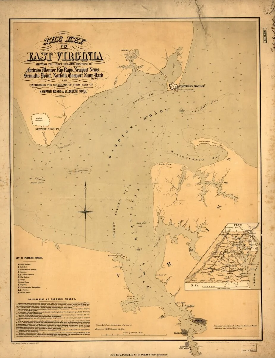
Map 1861 Hampton-Roads-Sea-Chart-925 Fortress Monroe Gosport Willoughby

Map 1861 Hampton-Roads-Sea-Chart-925 Fortress Monroe Gosport Willoughby

Map 1862 James River peninsula-campaign-1862-925 Civil War Trust

Map 1862 James River peninsula-campaign-1862-925 Civil War Trust

Map 1862 military map of SE VA

Map 1862 military map of SE VA

Map 1862 SE VA

Map 1862 SE VA

Map 1863 York River Hampton Roads to Ragged Island

Map 1863 York River Hampton Roads to Ragged Island

Map Virginia 1770

Map Virginia 1770

Nansemond River Bridge arial photo 1928

Nansemond River Bridge arial photo 1928

Theodore de Bry 1590-91

Theodore de Bry 1590-91

Western Branch 17th Century

Western Branch 17th Century

Western Branch 1750 - 1865

Western Branch 1750 - 1865

Western Branch 1880 - 1950

Western Branch 1880 - 1950

Western Branch 1950 - 2014

Western Branch 1950 - 2014

Bennetts Creek

Bennetts Creek

Chuckatuck Creek Map

Chuckatuck Creek Map

Constants Wharf Map

Constants Wharf Map

Crittenden 1860 - 1920

Crittenden 1860 - 1920

Crittenden 1930 - 2007

Crittenden 1930 - 2007

Suffolk Waters Map

Suffolk Waters Map

1630 Hondius Map of Virginia and Chesapeake Bay

1630 Hondius Map of Virginia and Chesapeake Bay

Craney Island Map - War of 1812

Craney Island Map - War of 1812

1 2 3 4 5 6 7 8 9 10 11 12 13 14 15 16 17 18 19 20 21 22 23
Previous Next
Chuckatuck Creek 1928
Fort Pulaski Map 1862
Map 1860's Ft Monroe and vicinity
Map 1861 Hampton-Roads-Sea-Chart-925 Fortress Monroe Gosport Willoughby
Map 1862 James River peninsula-campaign-1862-925 Civil War Trust
Map 1862 military map of SE VA
Map 1862 SE VA
Map 1863 York River Hampton Roads to Ragged Island
Map Virginia 1770
Nansemond River Bridge arial photo 1928
Theodore de Bry 1590-91
Western Branch 17th Century
Western Branch 1750 - 1865
Western Branch 1880 - 1950
Western Branch 1950 - 2014
Bennetts Creek
Chuckatuck Creek Map
Constants Wharf Map
Crittenden 1860 - 1920
Crittenden 1930 - 2007
Suffolk Waters Map
1630 Hondius Map of Virginia and Chesapeake Bay
Craney Island Map - War of 1812
SRH logo-K-150px.png
Suffolk River Heritage
8881 Eclipse Drive,
Suffolk, VA, 23433,
United States
info@suffolk-river-heritage.org
Hours
HomeArchivesPartner OrganizationsStoreContact

©2025 Suffolk River Heritage Foundation. All Rights Reserved.

Powered by The Addison Group